** Be Careful Out There **
The BLMA is a primitive outdoor setting which possesses inherent dangers to human beings. The BLMA is also not a park, and is thus not managed like a park. The BLMA is the NORTHWOODS, with actual, real-live, unpredictable wild animals (that don't like humans), biting insects, weather and Acts of GOD. It is very easy to get lost and injured in the woods of the BLMA and surrounding area - real easy - so don't venture into unknown areas, and don't exceed your means and/or skill level. There's no 'safety-net' out there. The public recreation facilities are open to the public and are provided free-of-charge. It should be understood that the recreation users assume a reasonable level of risk with their use and the activities associated with the BLMA Public Recreation Facilities.
Public Programs
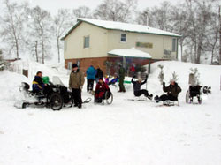
The Boulder Lake Environmental Learning Center hosts seasonal public programs. All programs are open to the public without discrimination. Some programs may require a fee; please call in advance to confirm. The Environmental Learning Center is located 18 miles north of Duluth, Minnesota. See map for details. Any questions about the public programs, please call us at (218)721-3731, or E-Mail Us at boulder@d.umn.edu
Hiking
Hiking Improved Trails
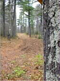
In general, the hiking opportunities at the BLMA are seemingly endless, whether you are looking for an improved trail, a primitive trail or are looking for your own way into the backcountry. Bring your hiking boots, rain gear, and bug dope!
Interpretive Trails
Bear Paw Trail provides access to the Sustainable Forestry Interpretative Trail.
The best times to hike the BLMA is early spring or the fall, beginning about mid-September.
The BLMA has about 20 kilometers of trail designated for hiking and many miles of backcountry area to wander.
* Notice on Deer and Horse Flies *
Hikers should be aware of the significant deerfly and horsefly population throughout the forested areas around the reservoir. Experienced hikers and resource managers note that the deerfly and horsefly population is the worst they've experienced in this region. Mid-June through early September experience the worst of the fly invasion. If you're not a 'headnet'-type of person, buy one and keep it in an easily accessed spot for quick retrieval while on the BLMA trails, during the summer. And while it may be very hot, we also recommend wearing a long-sleeve shirt and gloves, and possibly bug repellent.
* Notice on Ticks and Lyme's Disease *
Those who venture outside between April and July should check themselves for wood ticks, in particular. Throughout the spring and into the late fall, deer ticks may also be present. So be on the look-out for a much smaller sized tick than the wood tick. It is the deer tick which is a transmitter of Lyme's Disease.
*Notice on Hunting*
The BLMA is open to the public for hunting during the regular hunting seasons. Hunting seasons are usually scheduled for the following times: small game from September through December; bow and arrow for whitetail deer starting in September; waterfowl in October, bear in early fall, firearm for whitetail deer in November.
The Trails
 Bear Paw/Blue Ox Trailhead is accessed by driving north on State Aid Highway No. 4 (Rudy Perpich Memorial Highway), then two miles west-northwest on the Boulder Dam Road. The trails in this area are relatively easy with only a few wet/muddy spots. The trails take you through a mixed forest of 100-plus year-old white and red pines, pine thinning management locations, and areas more recently harvested for aspen tree regeneration. Blue Ox trail takes you past several small ponds (one of which has a viewing blind on the shore) which may attract frogs, turtles, mallards and wood ducks, and even a deer has been spotted at the shore. The trails are well-marked, and are designated cross-country ski trails in winter. Access across the bay is strictly a winter-time activity (the lake has to be frozen, of course).
The Rolling Pin Trailhead is one-half mile further down (north) the Boulder Dam Road from Bear Paw/Blue Ox Trail Head, adjacent to the entrance of the Environmental Learning Center. The trails in this area are more difficult with rolling hills and numerous low/wet/muddy areas. Forest in this area is mixed with birch, pine, balsam and aspen in the high ground areas; and willow, ash and spruce in the low land areas. A one-quarter mile long, thirty foot high ridge, believed to be a glacial esker, is located on the trail in this area. An esker is a ridge of river rock and sand deposits left behind from a river or stream which ran beneath the receding glaciers. Ridge Runner Trail runs along the top of this ridge. These trails are well-marked and are also designated cross-country ski trails in the winter. An interpretive trail, with messages which are periodically changed, is also located over this trail system. These trails possess a number of experimental study facilities including a deer-exclosure, study plots, and drift fences. These facilities are used in the formal education programs conducted from the Environmental Center.
Otter Run/Wolf Bay Trailhead is located another mile down the Boulder Dam Road from Rolling Pin Trailhead, at the Boulder Lake Dam Boat Launch. If you don't mind hiking a very primitive trail, add the Wolf Bay Trail to your hike; you'll add 8 kilometers (two-way) to your hike, and you can have your lunch at the Wolf Bay Campsite. If you use the fire grate at Wolf Bay Group Camp, please make sure your fire is dead-out before you leave.
Backcountry Hiking
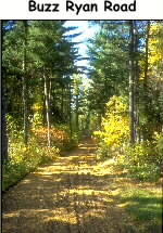 Opportunities to wander into the BLMA backcountry can be accessed off the Buzz Ryan Road at the northeast end of the BLMA. There are no designated trails in this area, so we highly suggest you bring along and know how to read a United States Geological Survey (USGS) topographic map, and know how to use a compass before venturing into known or unknown backcountry areas.
If you decide to head into this remote, heavily wooded area, you have a better chance of seeing evidence of the area's larger woodland wildlife, such as timber wolf, white-tailed deer, bear, and moose. Please note that during the summer the deer fly and horse fly populations are the most persistent in this area of the BLMA.
Access to the Buzz Ryan Road Trailhead parking is located 23 miles north of Duluth, from Minnesota from State Aid Highway No. 4, watching for the Buzz Ryan Road sign on the west side of the highway at a grove of red (Norway) pine trees, then down the Buzz Ryan Road. The Buzz Ryan Road is a dead-end, limited maintenance road, so please park well-off the road to allow others to pass unrestricted. The area is managed for aspen regeneration, the closer you get to the reservoir. Areas of pine are planted and periodically thinned along the Buzz Ryan Road.
top
Backcountry Skiing
Backcountry skiing can be accessed throughout the area, including the shoreline of the reservoir, but several locations are worth noting. The Wolf Bay Trail is not groomed, (unless someone has gone before you on either snowshoes or skis), but you will have a great backcountry experience covering up to 8 kilometers (two-way) if you make it to the Wolf Bay Campsite for lunch.
Other backcountry skiing can be accessed from the Buzz Ryan Road. We suggest you know how to read a USGS topographic map, and know how to use a compass before venturing into backcountry areas. But if you decide to head into this remote area, you have a better chance of seeing evidence of the area's larger woodland wildlife, such as timber wolf, white-tailed deer, bear, and moose. Access to the Buzz Ryan Road Trailhead is located 23 miles north of Duluth, from Minnesota State Aid Highway No. 4, watching for the Buzz Ryan Road sign on the west side of the highway at a grove of tall red (Norway) pine trees, then down the Buzz Ryan Road. The Buzz Ryan Road is a dead-end, limited maintenance road, so please park well-off the road to allow others to pass unrestricted.
top
Mountain Biking
The BLMA does not have designated mountain bike trails, but the area has many forest roads in the vicinity which are worth noting.
Boulder Dam Road is a paved road which accesses the Boulder Lake Reservoir Dam and the 1.6 kilometer (two-way) snowmobile access trail at the south side of the Boulder Lake Reservoir.
Buzz Ryan Road at the northeastern side of the BLMA is a 6.4 kilometer (two-way) trail which accesses several more kilometers of forest roads to explore.
Be sure to wear protective gear, including helmets, gloves, eye protection, etc..
Since mountain biking can cause significant rutting, erosion and worsen pothole problems, please avoid wet and muddy areas.
top
Snowshoeing
Visitors looking to snowshoe are welcome to use any of the trails in the North Trail System. See Trail Map.
Snowmobiling
A snowmobiling corridor has been established for a number of years between Island Lake and Boulder Lake reservoirs, located 1.5 miles down the Boulder Dam Road from Highway 4. No other trails are designated for snowmobile use in the BLMA, but many snowmobilers and ice anglers travel on the reservoir.
All-Terrain/Off-Highway Vehicles
All Terrain Vehicles/Off-Highway Vehicles (ATV's/OHV's) are permitted to drive on forest roads unless otherwise prohibited by signing, and/or local or state law or statute. No trails have been exclusively developed for (ATV's/OHV's).
top
Camping
Primitive Camping
Primitive campsites are open to the public on a first-come, first-serve basis and do not require a permit. See BLMA Recreation Map.
Group Camps
There are three Group Campsites on Boulder Lake Reservoir. Osprey, Moose Island, and Lady Island. See Map.
Group sites are often reserved for community groups through Boulder Lake Environmental Learning Center. Please call 218-721-3731 if you would like to reserve a group campsite for your school or civic organization.
If the sites are not being utilized by these groups, the sites are open to the public on a first come first serve basis.
The Group Camps look like a large version of a Boundary Water Canoe Area (BWCA) campsite. The sites hold up to twenty people, and include tent pads, box latrine, picnic table and pedestal fire ring.
Drive-up Camping
Silver Fox Lodge offers drive-up camping, primarily for campers for extended stay. Silver Fox Lodge is located from Highway Four to the Boulder Dam Road, then north on the Boulder Lake Road. The Boulder Lake Road ends at the lodge. Call in advance at (218)721-4840.
top
 Fishing
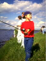
Walleye and northern pike are the two main game species in Boulder Lake Reservoir. You'll want to bring plenty of tackle, since the reservoir is studded with submerged stumps and boulders. This also does not bode well for outboard motor operators who are unfamiliar with the underwater hazards, therefore, Boulder Lake Reservoir does not lend itself to large outboard motors. On the other hand, the natural structure on the reservoir bottom creates great fish habitat and hideouts. Try this link to the MDNR fisheries data for Boulder Lake Reservoir.
Public water access is from the Boulder Lake Reservoir Dam Boat Launch at the end of the Boulder Dam Road. Access to the boat launch is located 18 miles north of Duluth, Minnesota from State Aid Highway No. 4 , then 3.5 miles on the Boulder Dam Road to the Boulder Lake Reservoir Dam Boat Launch.
*Notice On Exotic Species*
Area lakes, including Boulder Lake Reservoir, are susceptible to infestations of exotic species, including the Spiny Water Flea, Eurasian Milfoil, and Zebra Mussels. These species can be transmitted via boat bilge water and/or by being attached to boats, trailers and other boating equipment. The MDNR notes that these exotic species can severely impact aquatic ecology. Please thoroughly clean your boats and boating equipment before trailering your rig to a new lake.
top
Canoeing/Kayaking
You should realize that recreational boating on Boulder Lake Reservoir is primarily by motor. Here are some suggestions for avoiding or reducing the likelihood of encountering motorized activity.
Here is the current weather on Boulder Lake Reservoir, to plan your next outing.
Autumn is a better time to find fewer motorized boats on the Boulder Lake Reservoir. The most northeasterly shore of the reservoir (near Osprey Group Camp) is also the most wilderness-like, and the backwater bays make for a quality canoe outing. The bays to the south of the Environmental Center are also a good spot to get away from motors. Checkout Little Boulder, if the bog hasn't closed off your access. A 15 rod portage is located on the west side of the Boulder Lake Reservoir Dam to access Island Lake Reservoir.
A Word of Caution: the portage crosses Otter River Road (a private road) before reaching Island Lake Reservoir. Before crossing the road, please stop and look for traffic.
Hunting and Trapping
Hunting and trapping during regular hunting seasons and times is permitted within the BLMA. Hunters should follow all laws and rules mandated for the hunting of game animals and discharging of firearms.
top
Wildlife Watching
Bird Watching
The BLMA is home to over one-hundred species of birds throughout the year. A wide variety of aquatic and terrestrial habitats provide ample opportunity to view a wide range of birds at Boulder Lake. A Boulder Bird Checklist, which lists most of the birds you may see at the BLMA, is available at the Environmental Center. The western and south trail systems and the Buzz Ryan Road are good places to begin your search for birds. Checkout the map of the area to locate some of these prime watching areas.
The BLMA is also the site of much research concerning birds and their management. Studies investigating the effect of landscape-level variables, productivity of birds, and the distribution of breeding owls are all being conducted at Boulder Lake. In addition, the annual Boulder Birding Big Day, a friendly competition to identify the most bird species in one morning, is held annually at the BLMA in the spring.
Other Watchable Wildlife
Other forms of wildlife worth noting include whitetail deer, beaver, bear, moose and timber wolf. In winter, you run a good chance of seeing evidence of some of the more wary wildlife. Timberwolf tracks, for example, are quite prevalent throughout the area, including on the cross-country ski trails. A good number of beaver lodges are located on the reservoir shoreline, including one along the Nordberg road.
top
